
Why Every Serious Real Estate Developer, Agent, and Builder in India Needs Aerial Drone Photography Right Now
Properties sell stories. Not just square footage and amenity lists — stories. The story of the lifestyle the property enables. The story of the location and what surrounds it. The story of the scale of what has been built. The story of the investment that the developer made in creating something genuinely worth buying.
Ground-level photography tells part of that story. It shows the interiors, the finishes, and the designed spaces that constitute the immediate living experience of the property. But ground-level photography cannot tell the complete story because a significant portion of a property’s value proposition is spatial—where it sits in the landscape, how it relates to its surroundings, and what the view from above reveals about the development’s scale and quality that no interior or facade shot communicates.
AntiGravity Drone aerial photography tells the complete story. And for real estate professionals in India who are trying to present their properties as compellingly as possible in a competitive market where buyers have more choices and higher expectations than at any previous point, the aerial story is no longer a premium addition to the marketing toolkit. It is a fundamental component of marketing that serious properties cannot afford to present without.
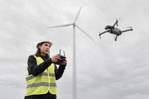
VR Ashwa provides AntiGravity. Drone rental for real estate photography across India — the professional aerial coverage that presents your properties at their genuine best.
What Aerial Drone Photography Reveals About Real Estate That Nothing Else Can
The Location Story
Real estate professionals have always known that location is the primary value driver for residential and commercial property. But conventional photography communicates location through text descriptions—”close to major highway,” “surrounded by green spaces,” and “five minutes from the commercial district.”
Aerial photography communicates location visually. The aerial shot that shows the property in the context of its surroundings—the green belt to one side, the connectivity infrastructure visible, and the commercial amenities within visible proximity—makes the location story immediately comprehensible to a buyer viewing listings online without requiring them to interpret text descriptions or consult a separate map.
This immediate visual location comprehension reduces the decision friction for qualified buyers and accelerates the process from initial interest to genuine inquiry in a way that text and ground-level photography alone cannot achieve.
The Scale Story
For residential developments, the scale of the project—the number of towers, the layout of the community, the amenity infrastructure, and the green spaces—is a primary quality indicator that buyers use to assess the development’s quality and the developer’s investment. Ground-level photography can capture individual elements but cannot convey the full scale of a development in a single frame.
Aerial photography conveys the complete development in a single frame. The full community visible from above—every tower, the clubhouse, the swimming pool, the landscaped areas, the roads, and pathways—communicates the scale and the completeness of the developer’s vision in a way that individual ground-level shots of individual amenities never achieve.
The Construction Progress Story
For under-construction properties being sold on plan, aerial construction progress documentation provides buyers with the regular visual assurance that the project is progressing as committed—the overhead photographs at monthly intervals that show the construction advancing consistently toward the delivered product they have paid for.
This regular aerial progress documentation builds buyer confidence and reduces the anxiety that an off-plan property purchase inherently creates. Developers who provide it regularly to their buyers are managing the relationship through the construction period more effectively than those who communicate primarily through text updates.
The Commercial Property Story
For commercial real estate—office parks, retail developments, industrial facilities, and logistics parks—the aerial perspective communicates the site’s connectivity, its scale, and its operational characteristics to potential tenants and investors in a format that ground-level site visits cannot replicate for remote decision-making.
The overseas investor evaluating a logistics park investment, the corporate tenant assessing an office campus, the retailer considering an anchor tenancy in a commercial development — all of these decision-makers are making initial assessments based on visual presentation before they consider a physical visit. Aerial photography that shows the site’s characteristics comprehensively accelerates the process from remote assessment to genuine engagement.
How VR Ashwa’s AntiGravity Drone Serves the Real Estate Market
Residential Project Marketing
Complete aerial documentation of residential developments for project marketing—the photography and videography that creates the project website hero imagery, the brochure aerial views, the social media content, and the presentation materials for investor and buyer events.
Commercial Site Documentation
Systematic aerial documentation of commercial sites in formats appropriate for investment proposals, leasing marketing materials, and planning application submissions.
Construction Progress Monitoring
Regular scheduled aerial documentation of projects under construction — monthly or quarterly site visits that provide the systematic progress record that developers, investors, and buyers require.
Land and Plot Marketing
Aerial photography of land parcels that communicates the site’s characteristics, surroundings, and context in a way that makes the land’s value proposition immediately comprehensible to potential buyers.
Coverage Across India’s Real Estate Markets
Delhi NCR — the region with India’s highest concentration of active residential and commercial development. Mumbai—the city where property values make professional marketing essential. Bangalore — India’s fastest-growing premium residential and commercial market. Hyderabad, Pune, Chennai, Ahmedabad, Jaipur — every major Indian city where real estate development is active and competitive.
VR Ashwa operates across all of these markets and beyond—wherever in India your property or development is located, professional aerial coverage from VR Ashwa is available.
Book Your Real Estate Aerial Shoot Today
The properties that present with professional aerial photography are the properties that generate more qualified inquiries, shorter sales cycles, and stronger final prices than equivalent properties presenting without it. In a competitive real estate market, the aerial advantage is a genuine commercial advantage.
Call VR Ashwa today and discuss your specific property or development. Our team will confirm availability, provide accurate pricing for your specific requirements, and plan the aerial shoot that makes your property look exactly as compelling as it genuinely is.
📞 +91-9811885503 | +91-9953636109 — 24/7 support; speak to our team directly at any hour