
Why India’s Infrastructure and Industrial Sectors Are Adopting the AntiGravity A1 for Inspection and Survey Work
India’s infrastructure is enormous, growing rapidly, and in consistent need of inspection and monitoring that conventional ground-based methods handle at a fraction of the efficiency that professional aerial solutions provide.
The transmission line that runs for hundreds of kilometers across varied terrain. The bridge structure whose deck and support elements require regular inspection for structural integrity. The industrial facility whose roofing, pipework, and external structure require systematic monitoring for maintenance planning. The solar farm whose panel performance needs an aerial thermal assessment to identify underperforming sections. The road and highway network whose condition requires systematic documentation for maintenance prioritization.
All of these inspection requirements share a common characteristic—the data collection is spatial, the assets are too large for efficient ground-based assessment, and the information needed to manage the assets well requires the aerial perspective that puts the inspector above the asset rather than alongside it.
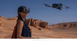
The AntiGravity A1, deployed professionally by VR Ashwa, is the aerial platform that infrastructure and industrial operators across India are adopting for these inspection and survey requirements. This guide explains what it delivers and why the 8K resolution and professional payload capability make it specifically appropriate for serious infrastructure and industrial applications.
Why Infrastructure Inspection Has Specific Requirements That Event Drones Do Not Meet
The drone that works well for wedding photography and the drone that works well for infrastructure inspection are not necessarily the same drone. The requirements are genuinely different in ways that matter for the quality of the inspection data collected.
Systematic coverage is the primary operational requirement for inspection and survey work. The ability to fly consistent, planned coverage patterns across large areas—maintaining consistent altitude, consistent image overlap for mapping applications, and consistent speed for data collection uniformity—requires flight planning capability and flight execution precision that event-oriented drone deployment does not necessarily prioritize.
Specialized sensor integration is the requirement that expands inspection capability beyond standard visual photography. Thermal imaging is for identifying heat anomalies in electrical infrastructure, for detecting water ingress in roofing systems, and for identifying performance variations in solar installations. Multispectral imaging for agricultural crop health assessment and irrigation monitoring. High-resolution vertical photography for the photogrammetric processing that produces the orthomosaic maps and 3D models that engineering analysis requires.
Data quality and format requirements for inspection applications are more specific than for photography applications. The inspection data needs to be in formats that engineering analysis software can process, that GIS systems can incorporate, and that produce the measurement accuracy that infrastructure management decisions depend on.
The AntiGravity A1’s professional specification and VR Ashwa’s infrastructure inspection operational expertise address all three of these specific requirements.
The Specific Infrastructure Applications
Transmission Line and Power Infrastructure Inspection
India’s power transmission infrastructure extends across terrain that makes ground-based inspection expensive, slow, and in some cases practically impossible. The AntiGravity A1’s inspection capability provides the systematic aerial assessment of transmission line condition—the insulator inspection, the conductor assessment, and the tower structural evaluation—that ground-based inspection cannot replicate at equivalent efficiency.
The thermal imaging payload capability identifies hot spots in electrical infrastructure that indicate developing faults before those faults become failures. The early identification of developing electrical faults is the specific inspection value that prevents the costly, damaging, and sometimes dangerous failures that undetected fault progression produces.
Bridge and Civil Structure Inspection
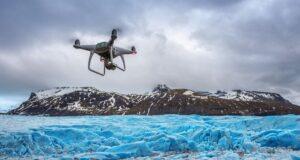
Bridge inspection requirements include both the visual assessment of structural elements and the measurement data that structural analysis requires. The AntiGravity A1’s 8K visual capture and photogrammetric coverage capability provides both the high-resolution imagery that allows detailed visual assessment of structural condition and the systematic coverage that photogrammetric processing converts into the measurement data that structural engineers need for analysis.
The specific elements of bridge inspection that aerial coverage addresses most effectively include the deck surface condition, the parapet and barrier condition, the pier and abutment faces below deck level, and the overall structural geometry that systematic photogrammetric survey documents.
Industrial Facility Inspection
Large industrial facilities—refineries, chemical plants, manufacturing complexes, and logistics parks—require systematic exterior inspection for maintenance planning that ground-based inspection performs slowly and at significant access cost. The AntiGravity A1’s aerial inspection provides the complete facility exterior assessment in a fraction of the time and cost of ground-based alternatives.
Roofing inspection for water ingress risk identification. External pipework condition assessment. Tank exterior condition monitoring. Structural element inspection across areas that require elevated access equipment for ground-based inspection. All of these are addressed by systematic aerial inspection at an efficiency advantage that becomes more valuable as facility scale increases.
Solar Farm Performance Monitoring
India’s rapidly growing solar energy sector creates significant demand for the aerial thermal inspection that identifies underperforming panels and sections within large installations. The thermal imaging capability of the AntiGravity A1 provides the systematic thermal survey of solar installations that ground-based assessment cannot replicate at the scale of modern solar farms.
The thermal data that identifies panels with connection faults, soiling-related performance losses, and manufacturing defects translates directly into maintenance prioritization that maximizes the energy production and return on investment of solar assets.
Data Deliverables for Infrastructure Applications
The inspection data deliverables from VR Ashwa’s AntiGravity A1 infrastructure operations are formatted for the professional purposes the inspection data serves.
Orthomosaic maps for spatial reference and GIS integration. Point cloud and 3D model outputs for structural measurement and analysis. Thermal inspection reports with annotated images identifying anomalies for maintenance action. High-resolution imagery sets are for visual inspection and condition assessment. All deliverables are provided in the industry-standard formats that infrastructure management systems and engineering analysis software require.
Booking AntiGravity A1 Infrastructure Inspection With VR Ashwa
For infrastructure inspection and industrial survey inquiries, the detailed operational planning that these applications require begins with the initial project consultation.
📞 +91-9811885503 | +91-9953636109 — Available 24 hours a day, 7 days a week 🌐 www.vrashwa.com
Call VR Ashwa with your infrastructure inspection requirements. We will discuss the operational approach, the data deliverables, and the regulatory compliance for your specific assets and locations.