Why the AntiGravity A1 Is the Travel Creator’s Most Powerful Tool for Capturing India From Above
India from the ground is extraordinary, and from above, it is something else entirely.
The ghats of Varanasi are seen from directly above—the steps descending to the river in the early morning light, the boats arranged along the waterfront, the centuries of ritual and life visible in the spatial organization of the riverbank that no ground-level camera can frame in a single shot. The dunes of Rajasthan from altitude — the wave pattern of the desert surface extending to the horizon with the scale that only aerial perspective communicates. The backwaters of Kerala from above — the intricate network of waterways, the houseboats, the coconut palms, and the villages that constitute one of the world’s most distinctive landscapes, visible in its complete spatial logic only from the air.
Travel content creation in India in 2026 is a genuinely competitive field. The quality of aerial footage is one of the clearest differentiators between travel content that builds serious audiences and travel content that is adequately produced but fails to distinguish itself from the enormous volume of similar content that the same locations generate every year.
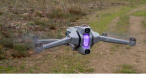
The AntiGravity A1′s 8K 360° capability is the specific technical foundation that enables travel creators to produce aerial footage of Indian destinations at a quality level that stands out in the competitive travel content environment.
VR Ashwa deploys the AntiGravity A1 for travel creators across India — providing the professional aerial service that creators can incorporate into their travel productions without the complexity of owning and operating professional drone equipment independently.
What 8K Resolution Changes About Travel Content Quality
The fundamental quality difference that 8K aerial footage provides for travel content is the ability to communicate the visual richness of Indian destinations at the resolution the destinations deserve.
Indian heritage sites are architecturally complex in ways that lower-resolution aerial photography compresses and generalizes. The carved stone detail of the temples at Khajuraho. The intricate tile work of the mosques and palaces of Rajasthan. The structural engineering of the stepped wells of Gujarat. These architectural details are the specific content that travel audiences engage with—the visual evidence of the cultural and artistic heritage that makes Indian destinations genuinely fascinating rather than just visually impressive from altitude.
At 8K resolution from the AntiGravity A1, these details are present in the aerial footage. The temple carvings are visible from altitude in a way that communicates the architectural complexity of the monument. The inlay work of heritage palace façades is resolved clearly enough that the footage tells a story about the craftspeople who created it rather than simply recording the building’s impressive scale.
This detail at altitude is the specific quality that travel content audiences respond to—the footage that is informative about the destination rather than merely atmospheric—and it is the quality that the AntiGravity A1’s 8K resolution makes available to travel creators.
The 360° Advantage for Travel Production Workflows
Travel content production involves constraints that studio production does not. The time pressure of a specific location. The natural light that is present at a specific time of day and gone twenty minutes later. The access window that tourism regulations, weather conditions, and location logistics create. The impossibility of going back tomorrow to capture the shot that was missed today when tomorrow you are eight hundred kilometers away.
These constraints make the 360° capture advantage of the AntiGravity A1 specifically valuable for travel production in a way that amplifies its general workflow benefits.
The golden hour at a Rajasthan fort location that provides twenty minutes of the specific warm directional light that makes the footage genuinely extraordinary — the AntiGravity A1’s 360° capture records the complete sphere around the drone throughout those twenty minutes. Every direction. Every angle. Every composition that the light creates simultaneously from the drone’s position above the fort.
In post-production, the editor and the creator can explore all of those compositions — the ones that were consciously planned in the field and the ones that exist in the spherical record and are discovered during the editing process. The shot that works best for the specific sequence in the travel film is chosen from the complete creative material rather than from the limited directional footage that committed camera-pointing produces under time pressure.
The Specific Indian Destinations Where AntiGravity A1 Footage Changes Everything
Rajasthan — The Heritage Landscape
Rajasthan provides the most immediately compelling case for premium aerial travel content in India — the combination of extraordinary architectural heritage, dramatic natural landscape, and the visual culture of the state creates aerial footage that is visually unlike anywhere else in the world.
The AntiGravity A1’s coverage of Rajasthani forts and palaces from altitude captures both the architectural complexity that the 8K resolution resolves clearly and the landscape context—the desert terrain, the surrounding settlements, and the relationship between the monuments and the geography they were built to command—that makes the footage genuinely informative about the historical and cultural significance of the sites rather than simply impressive in its visual scale.
Kerala — Backwaters and Coastal Landscape
The Kerala backwater landscape is among the most distinctive in India, and the aerial perspective reveals its spatial logic in a way that ground-level travel photography cannot approach. The network of waterways, the arrangement of settlements and cultivation along the water margins, the houseboats, and the coconut landscape are all visible simultaneously from above in the complete spatial organization that makes the backwaters extraordinary.
The AntiGravity A1’s coastal operation capability — the flight stability in the sea breeze conditions that coastal Kerala creates and the camera performance in the high-humidity coastal environment — makes professional aerial coverage of Kerala destinations consistently achievable rather than weather-dependent.
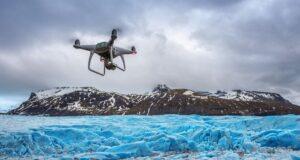
Himalayan Terrain — Mountains and Hill Stations
The Himalayan landscape provides aerial footage that requires both the image quality to capture the scale and detail of mountain terrain and the flight capability to operate reliably in the altitude and wind conditions that mountain locations create. The AntiGravity A1’s performance in these conditions supports the mountain terrain coverage that travel content from Himalayan destinations requires.
Working With VR Ashwa for Travel Production
Travel creators who incorporate VR Ashwa’s AntiGravity A1 aerial service into their production planning gain the professional aerial capability without the operational complexity of independent drone operation across multiple Indian locations.
The regulatory compliance for each location is managed by VR Ashwa — the Digital Sky permissions for heritage sites, protected areas, and the various regulated airspace environments that Indian travel destinations create.
The operational expertise for each specific location type—the heritage site protocol, the coastal operation management, and the mountain terrain operation planning—comes with VR Ashwa’s experienced operators rather than requiring the creator to develop this expertise independently.
📞 +91-9811885503 | +91-9953636109 — Call our team to plan your travel production aerial 🌐 www.vrashwa.com
Call VR Ashwa and capture it at the quality it deserves.