
How the AntiGravity A1 Is Transforming Land Survey, Mapping, and Geospatial Data Collection in India
India has a land survey problem that has existed for generations and that has significant economic, legal, and developmental consequences across the country.
The land records that determine property rights, taxation, development permissions, and resource allocation are inconsistently accurate, irregularly updated, and insufficiently detailed for the demands that rapid urbanization, infrastructure development, and resource management are placing on the national geospatial information system.
The conventional survey methods that produced these records—ground-based total station surveying, manual field mapping, and satellite imagery interpretation—are either too slow, too expensive, too coarsely resolved, or some combination of all three to keep pace with the speed at which India’s land use is changing and the precision with which contemporary land management requires it to be documented.
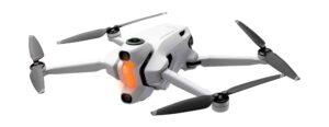
The AntiGravity A1, deployed professionally by VR Ashwa for survey and mapping applications, provides the aerial data collection capability that bridges this gap — the systematic coverage, the resolution, and the data quality that photogrammetric processing converts into the mapping products that professional survey applications require.
What Photogrammetric Drone Survey? Actually Produces
The output of a professional drone survey with the AntiGravity A1 is not simply a set of aerial photographs. It is the processed geospatial data products that survey applications require — the orthomosaic maps, the digital elevation models, the 3D point clouds, and the quantitative measurement outputs that engineering analysis, planning applications, and land management decisions depend on.
The orthomosaic map is the georeferenced aerial image mosaic that combines hundreds or thousands of individual aerial photographs into a single seamless map with geometric accuracy that supports measurement and GIS integration. The accuracy of the orthomosaic depends on both the image quality—where the AntiGravity A1’s 8K resolution provides the image detail that high-accuracy photogrammetric processing requires the systematic coverage that provides the overlap and the ground control that photogrammetric accuracy standards demand.
The digital elevation model is the three-dimensional representation of the terrain surface—the height data that topographic mapping, drainage analysis, volume calculation, and infrastructure design planning require. The AntiGravity A1’s systematic survey coverage provides the image overlap that photogrammetric algorithms require to generate accurate elevation models from the aerial photography.
The 3D point cloud provides the three-dimensional spatial data that is used for building information modeling, structural analysis, heritage documentation, and the range of professional applications that require three-dimensional spatial representation rather than two-dimensional mapping.
The Specific Survey Applications
Cadastral and Land Record Survey
The updating and accuracy improvement of land records — the cadastral survey that documents property boundaries, land use, and the spatial information that land rights and taxation administration require — is the survey application with the broadest social and economic significance in India.
A drone survey with the AntiGravity A1 provides cadastral survey data at the resolution and accuracy that property boundary identification requires, across the area extents that a manual ground survey cannot cover at comparable efficiency. The systematic aerial coverage of village land areas and urban development zones produces the mapping products that cadastral record modernization requires at a fraction of the time and cost of equivalent ground survey methods.
Urban Development and Planning Survey
The rapid pace of Indian urban expansion requires equally rapid urban survey capability—the accurate, current spatial data that urban planning, infrastructure design, and development regulation administration depend on. Drone surveys provide the frequent, comprehensive, high-resolution urban survey data that satellite imagery cannot provide at adequate resolution and that ground surveys cannot cover at adequate speed.
The AntiGravity A1’s 8K survey coverage of urban development areas provides the spatial data resolution that building extraction, road network mapping, and land use classification require for planning and development management applications.
Mining and Quarrying Volume Assessment
Mining operations require accurate volume calculations—the stockpile volumes, the extraction volumes, and the cut and fill quantities that operational management and royalty calculations depend on. The photogrammetric volume calculation from AntiGravity A1 survey data provides the accurate, repeatable volume assessments that mining operations require at a fraction of the cost and time of conventional ground-surveying methods.
Flood Management and Drainage Planning
The digital elevation models produced from AntiGravity A1 survey data support the hydraulic modeling and drainage analysis that flood management planning requires. The accurate terrain height data that identifies drainage catchments, flood risk zones, and the infrastructure design requirements for effective drainage management is produced from systematic drone surveys at the accuracy that hydraulic analysis requires.
VR Ashwa’s Survey Operational Capability
VR Ashwa’s AntiGravity A1 survey operations include the complete technical infrastructure that professional survey applications require — the ground control point establishment that photogrammetric accuracy demands, the systematic flight planning that provides the coverage and overlap specifications the application requires, and the photogrammetric processing and quality assurance that produces the deliverable accuracy the project specification defines.
Survey deliverables include the georeferenced orthomosaic, the digital elevation model, the 3D point cloud, and the quantitative outputs—area measurements, volume calculations, and linear measurements—that the survey application requires, in the file formats that GIS and engineering analysis software can incorporate directly.
📞 +91-9811885503 | +91-9953636109 — Survey enquiries welcome at any hour 🌐 www.vrashwa.com
For survey projects across India, VR Ashwa brings the AntiGravity A1’s 8K survey capability to your project location with the operational expertise and the data processing infrastructure that professional survey applications require.