Disasters don’t arrive with structure. They break routines, scatter people, block roads, and turn familiar places into something unrecognizable. A street becomes a river. A school becomes a shelter. A hill collapses and erases a village line by line. In those first hours, nothing feels organized. Communication fails. Maps stop making sense. What worked yesterday no longer works.
This is where drones began finding their place. Not as heroes, not as replacements for people, but as quiet tools that can move when humans cannot.
Why Ground-Level View Is Limited
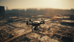
When a disaster hits, the ground is usually the worst place to understand it. Smoke hides damage. Floodwater hides roads. Debris hides people. From the ground, responders see fragments—one collapsed house, one injured group, one blocked lane. But disasters don’t happen in fragments. They spread. They connect. They ripple outward.
A drone lifts above that confusion and shows the damage as it actually exists. It is not dramatic or cinematic; it is wide, honest, and uncomfortable.
Floods: Seeing What the Water Hides
After floods, entire neighborhoods can look calm from street level. Water recedes, people stand outside, life seems paused. From the air, the truth shows up clearly. Breached embankments. Washed-away bridges. Crops flattened in patterns that show how water moved and where it will return if rain comes again. Rescue teams don’t guess anymore. They see.
Earthquakes: Mapping Collapse
During earthquakes, time matters more than anything else. Buildings fall in strange ways. Some collapse inward. Some lean and trap voids inside. From the ground, it’s impossible to know where those voids might be. Drones fly low and slow, scanning cracks, shadows, angles. Not every flight finds survivors, but every flight reduces blind searching. That matters when minutes turn into hours.
Fires: Tracking the Spread
Fires create another kind of chaos. Smoke shifts. Wind changes direction. What looks contained suddenly jumps a road and eats into forest or homes. Firefighters on the ground feel heat and noise, but they can’t see the fire’s shape. Drones show edges. They show spread. They show where fire is thinning and where it’s gathering strength. Decisions stop being reactive and become slightly more informed.
Landslides and Remote Areas
In landslides, especially in hilly or remote regions, access itself becomes the enemy. Roads vanish. Footpaths crumble. Heavy machinery can’t reach. Drones reach first. They don’t clear debris. They don’t rescue anyone directly. But they answer the most urgent question early on—where is it worst, and where do we start?
Guiding Rescue Efforts
Rescue operations are often imagined as dramatic pulls from rubble or helicopters lifting people to safety. In reality, most of the work is slow and exhausting. Searching empty homes. Checking lists. Confirming who is missing and who is safe. Drones quietly assist here too. They count rooftops with people waving. They identify clusters of stranded families. They notice movement in places thought abandoned.
Flood Zones: Locating Stranded People
In flood zones, people often take shelter on higher floors or roofs. From the ground, these spots can remain hidden for days. From above, human presence is visible in small signs—clothes laid out, hand signals, groups moving together. Drones don’t rescue, but they guide rescuers to where it actually matters.
Safety for Rescue Teams
Another reality rarely discussed is safety for rescue teams themselves. Disasters don’t end when the first wave passes. Structures remain unstable. Gas leaks linger. Water currents shift. Sending people blindly into damaged zones creates more victims. Drones reduce that risk. They inspect before humans enter. They show hanging debris, weakened walls, unstable slopes. This results in fewer assumptions and fewer unnecessary injuries.
Coordination Between Teams
Coordination also changes. Disaster response involves many groups—local authorities, national forces, volunteers, medical teams, NGOs. Everyone has pieces of information, but those pieces don’t always connect. Drone footage becomes a shared reference. A common view. Meetings stop being arguments and become planning sessions. Everyone sees the same damage, the same gaps, the same priorities.
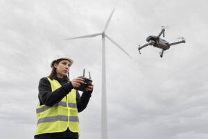
Remote and Hard-to-Reach Areas
In remote disasters, especially in mountains, forests, or coastal regions, drones sometimes become the only eyes available. Helicopters are expensive and have limited availability, and satellites don’t offer real-time clarity at low altitude; drones fill that space. They fly below clouds, below smoke layers, and return with immediate data. It’s not perfect, but it is useful.
Post-Disaster Assessment
There is also a quieter use that rarely makes headlines—damage assessment after rescue slows down. Governments need to know what is lost. How many homes. Which roads. Which farms. Insurance teams need proof. Communities need acknowledgment. Drones document reality without flattening it into numbers too early. They show loss honestly, even when it’s uncomfortable to watch.
Ethics and Respect
However, drones are not neutral by default. How they are used matters. Flying too low invades privacy. Hovering over suffering people can feel cruel. Recording without purpose turns disaster into spectacle. This is where human judgment matters more than technology. The best drone operations are barely noticed. They stay distant. They collect information, not emotions.
Local operators matter here. People who know the terrain, the seasons, the wind behavior, the cultural boundaries. They know when not to fly. They know which angles help and which cross a line. Technology alone doesn’t bring sensitivity. People do.
Learning and Building Resilience
As disasters become more frequent and less predictable, the role of drones keeps expanding. Not loudly. Not dramatically. Slowly. They slip into emergency kits, response protocols, training manuals. This is not because they look impressive, but because they reduce uncertainty just enough to make decisions clearer.
At the end of every disaster response, when the noise fades and attention moves on, drone footage often remains. It becomes part of reports, reviews, and lessons learned. It shows what worked. It shows what didn’t. It doesn’t forget.
The True Value of Drones
Drones don’t stop disasters. They don’t heal loss. They don’t replace human courage or exhaustion. What they do is simple and powerful—they let people see clearly in moments when clarity is rare. Sometimes, that small advantage changes everything.